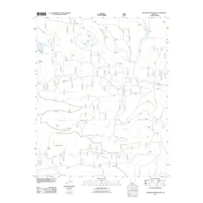
2011 Map of Magazine Mountain NE
USGS Topo · Published 2011About this map
Cove Lake and its surrounding recreational lands anchor this portion of the Logan County landscape, where the Cove Lake Campground sits at the foot of Flattop Mountain. The terrain is defined by a dense network of ridges and hollows, including North Pointer Ridge and Bear Hollow, which dictate the winding paths of the Rich Mountain Road Byway. Small settlements like Greenfield and Millard appear as quiet crossroads within a landscape dominated by watercourses such as Lee Creek and Big Shoal Creek.
Find a feature on this map
44 named features on this map. Tap any name to fly to it.
Don’t see what you’re looking for? This feature index may not catch every label — zoom into the map to look around manually.
Map Details
Editions of this 2011 Magazine Mountain NE Map
This is the sole edition of this map. No revisions or reprints were ever made.
Other maps of this area

1879 · Mountain Home
USGS Topo · 1:62,500

1887 · Magazine Mountain #1
USGS Topo · 1:62,500

1887 · Magazine Mountain #4
USGS Topo · 1:62,500

1887 · Magazine Mountain
USGS Topo · 1:62,500

1888 · Dardanelle #2
USGS Topo · 1:62,500

1888 · Dardanelle #3
USGS Topo · 1:62,500

1890 · Magazine Mountain
USGS Topo · 1:125,000

1890 · Dardanelle
USGS Topo · 1:125,000

1956 · Russellville
USGS Topo · 1:250,000
1961 · Scranton
USGS Topo · 1:24,000