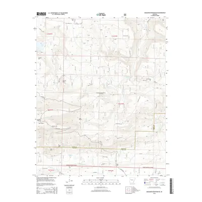
2014 Map of Magazine Mountain NE
USGS Topo · Published 2014About this map
Ozark National Forest dominates this Arkansas landscape, where the high elevations of Magazine Mtn and Rich Mtn define the local topography. This 2014 survey documents a rugged section of the Arkansas River Valley's southern highlands, characterized by sharp ridges like N Pointer Ridge and Mossback Ridge. These landforms create a complex drainage network, sending waters through Big Shoal Cr and Little Piney Cr.
Find a feature on this map
65 named features on this map. Tap any name to fly to it.
Don’t see what you’re looking for? This feature index may not catch every label — zoom into the map to look around manually.
Map Details
Editions of this 2014 Magazine Mountain NE Map
This is the sole edition of this map. No revisions or reprints were ever made.
Other maps of this area

1879 · Mountain Home
USGS Topo · 1:62,500

1887 · Magazine Mountain #1
USGS Topo · 1:62,500

1887 · Magazine Mountain #4
USGS Topo · 1:62,500

1887 · Magazine Mountain
USGS Topo · 1:62,500

1888 · Dardanelle #2
USGS Topo · 1:62,500

1888 · Dardanelle #3
USGS Topo · 1:62,500

1890 · Magazine Mountain
USGS Topo · 1:125,000

1890 · Dardanelle
USGS Topo · 1:125,000

1956 · Russellville
USGS Topo · 1:250,000
1961 · Scranton
USGS Topo · 1:24,000