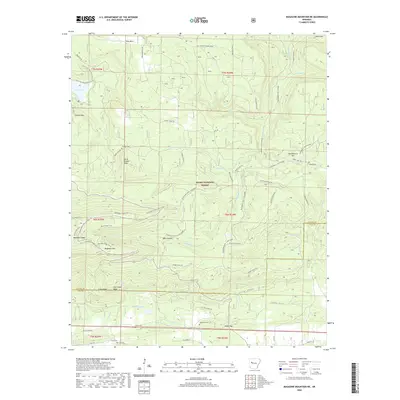
2020 Map of Magazine Mountain NE
USGS Topo · Published 2020About this map
Magazine Mtn anchors this section of the Ozark National Forest, where the boundary between Logan and Yell counties follows the high ridgelines. The landscape is defined by an extensive network of fire roads and recreational paths, including the N-Rim-Trail, Greenfield Trail, and Mossback Ridge Trail. To the northwest, Cove Lake serves as a significant water feature, surrounded by the Cove Lake Perimeter & N Lo road.
Find a feature on this map
65 named features on this map. Tap any name to fly to it.
Don’t see what you’re looking for? This feature index may not catch every label — zoom into the map to look around manually.
Map Details
Editions of this 2020 Magazine Mountain NE Map
This is the sole edition of this map. No revisions or reprints were ever made.
Other maps of this area

1879 · Mountain Home
USGS Topo · 1:62,500

1887 · Magazine Mountain #1
USGS Topo · 1:62,500

1887 · Magazine Mountain #4
USGS Topo · 1:62,500

1887 · Magazine Mountain
USGS Topo · 1:62,500

1888 · Dardanelle #2
USGS Topo · 1:62,500

1888 · Dardanelle #3
USGS Topo · 1:62,500

1890 · Magazine Mountain
USGS Topo · 1:125,000

1890 · Dardanelle
USGS Topo · 1:125,000

1956 · Russellville
USGS Topo · 1:250,000
1961 · Scranton
USGS Topo · 1:24,000