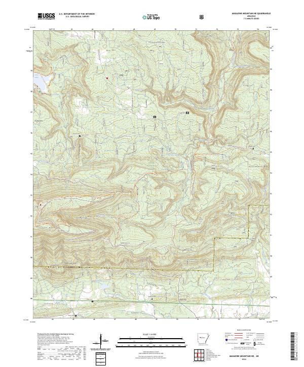
2024 Map of Magazine Mountain NE
USGS Topo · Published 2024About this map
Ozark National Forest dominates this landscape, where the high elevations of the Arkansas River Valley meet specialized recreational corridors and quiet burial grounds. The map shows a complex network of multi-use pathways, including the Huckleberry Mtn Horse Trl, Mossback Ridge Trl, and the Cove Lake Perimeter & Nature Trl circling Cove Lake. These trails reflect the area's development for forest recreation over decades. Local history is anchored by several rural cemeteries such as Antioch Cem, Liberty Cem, and Valentine Cem, which provide essential points of reference for genealogists tracing families in this part of Logan and Yell counties. Prominent peaks including Magazine Mountain, Rich Mtn, and the distinct elevations of Snake Knob and East Snake Knob define the skyline, while drainage flows through numerous branches like Gobbel Branch and Little Piney Creek.
Find a feature on this map
67 named features on this map. Tap any name to fly to it.
Don’t see what you’re looking for? This feature index may not catch every label — zoom into the map to look around manually.
Map Details
Editions of this 2024 Magazine Mountain NE Map
This is the sole edition of this map. No revisions or reprints were ever made.
Other maps of this area

1879 · Mountain Home
USGS Topo · 1:62,500

1887 · Magazine Mountain #1
USGS Topo · 1:62,500

1887 · Magazine Mountain #4
USGS Topo · 1:62,500

1887 · Magazine Mountain
USGS Topo · 1:62,500

1888 · Dardanelle #2
USGS Topo · 1:62,500

1888 · Dardanelle #3
USGS Topo · 1:62,500

1890 · Magazine Mountain
USGS Topo · 1:125,000

1890 · Dardanelle
USGS Topo · 1:125,000

1956 · Russellville
USGS Topo · 1:250,000
1961 · Scranton
USGS Topo · 1:24,000