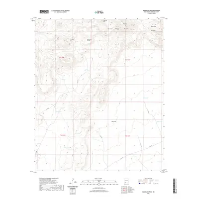
2020 Map of Magdalena Peak
USGS Topo · Published 2020About this map
The high desert terrain of the Sierra de las Uvas dominates this section of Doña Ana County, defined by its complex network of canyons and peaks. Rising prominently in the northeast, Magdalena Peak and Sugarloaf Peak overlook deep-cut drainages like Valles Canyon and Silva Canyon. This landscape is primarily shaped by water management for ranching or local livestock, evidenced by the numerous named catchments distributed across the townships, including Tajanio Pinto Tank, Lone Tree Tank, and Kerr Tank.
Find a feature on this map
31 named features on this map. Tap any name to fly to it.
Don’t see what you’re looking for? This feature index may not catch every label — zoom into the map to look around manually.
Map Details
Editions of this 2020 Magdalena Peak Map
This is the sole edition of this map. No revisions or reprints were ever made.
Other maps of this area

1943 · Corralitos Ranch
USGS Topo · 1:62,500

1955 · Las Cruces
USGS Topo · 1:250,000

1958 · Las Cruces
USGS Topo · 1:250,000
1959 · Sierra Alta
USGS Topo · 1:24,000
1959 · Souse Springs
USGS Topo · 1:24,000

1961 · Nutt
USGS Topo · 1:62,500

1972 · Good Sight Peak NE
USGS Topo · 1:24,000

1972 · Lazy E Ranch
USGS Topo · 1:24,000

1982 · Hatch
USGS Topo · 1:100,000
1982 · Deming
USGS Topo · 1:100,000