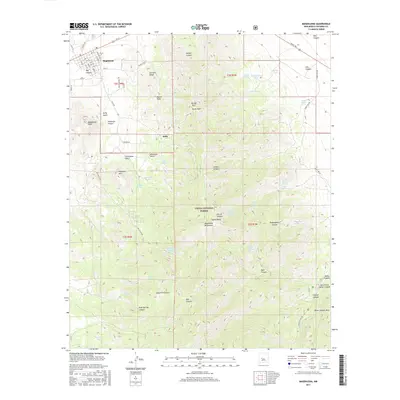
2017 Map of Magdalena
USGS Topo · Published 2017About this map
Magdalena and the nearby settlement of Kelly sit at the foot of the high Magdalena Mountains, an area where the grid-work of small-town streets meets the steep, spring-fed drainages of the Cibola National Forest. The landscape is dominated by high summits including Magdalena Peak, North Baldy, and North Peak, which tower over a network of canyons such as Hop Canyon, Mill Canyon, and Shakespeare Canyon. This 2017 survey details a water-scarce environment where named resources like the Magdalena Municipal Water Shed and scattered basins such as Rowden Tank and Hell Canyon Tank were critical to local life. Genealogists and historians can trace the transition from the town's residential core along Main St and 1st St to the more isolated landmarks found in Patterson Canyon and Kelly Gulch.
Find a feature on this map
80 named features on this map. Tap any name to fly to it.
Don’t see what you’re looking for? This feature index may not catch every label — zoom into the map to look around manually.
Map Details
Editions of this 2017 Magdalena Map
This is the sole edition of this map. No revisions or reprints were ever made.
Other maps of this area

1954 · Tularosa
USGS Topo · 1:250,000

1954 · Socorro
USGS Topo · 1:250,000

1958 · Socorro
USGS Topo · 1:250,000

1958 · Tularosa
USGS Topo · 1:250,000

1959 · Magdalena
USGS Topo · 1:62,500

1962 · Socorro
USGS Topo · 1:250,000

1963 · Arroyo Landavaso
USGS Topo · 1:24,000

1964 · Silver Hill
USGS Topo · 1:24,000
1965 · Squaw Peak
USGS Topo · 1:24,000
1965 · South Baldy
USGS Topo · 1:24,000