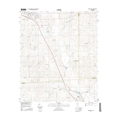
2015 Map of Magee South
USGS Topo · Published 2015About this map
Okatoma Creek and Uspoha Cr carve through this Mississippi landscape, providing a natural drainage system for the communities south of Magee. The settlement pattern follows the local topography, with established centers like Saratoga, McNair, and Mount Olive serving as anchors for the surrounding rural territory. This 2015 survey reveals a terrain defined by agricultural and timber interests, evidenced by the prominent McNair Millpond and several creek-side reservoirs. Local heritage is deeply rooted in family and community burial grounds, such as Sharon Cem and Siloam Cem, which dot the hillsides between the main thoroughfares. Smaller hamlets like Coats and the evocatively named Merry Hell highlight the dispersed nature of the population, while Dry Cr Lake serves as a significant hydrological feature in the southern portion of the quadrangle.
Find a feature on this map
150 named features on this map. Tap any name to fly to it.
Don’t see what you’re looking for? This feature index may not catch every label — zoom into the map to look around manually.
Map Details
Editions of this 2015 Magee South Map
This is the sole edition of this map. No revisions or reprints were ever made.
Other maps of this area

1953 · Hattiesburg
USGS Topo · 1:250,000

1958 · Hattiesburg
USGS Topo · 1:250,000

1970 · Mendenhall East
USGS Topo · 1:24,000

1970 · Mount Carmel
USGS Topo · 1:24,000
1971 · Mendenhall SE
USGS Topo · 1:24,000

1974 · Lone Star
USGS Topo · 1:24,000

1974 · Collins
USGS Topo · 1:24,000
1975 · Cohay
USGS Topo · 1:24,000

1975 · Mize
USGS Topo · 1:24,000
1975 · Magee North
USGS Topo · 1:24,000