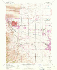
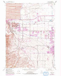
1952 Map of Magna
USGS Topo · Published 1971About this map
Industrial and suburban expansion defines the landscape between the Oquirrh Mountains and the Great Salt Lake shoreline. The town of Magna serves as a central hub, flanked by significant educational infrastructure including Cyprus High Sch and Webster Sch. To the north, a massive Tailings Pond and the Duck and Fish Club mark the edge of the wetlands, while the industrial character of the region is anchored by the Powder Plant near Bacchus.
Find a feature on this map
35 named features on this map. Tap any name to fly to it.
Don’t see what you’re looking for? This feature index may not catch every label — zoom into the map to look around manually.
Map Details
Editions of this 1952 Magna Map
6 editions found
Other maps of this area

1885 · Salt Lake
USGS Topo · 1:250,000

1885 · Tooele Valley
USGS Topo · 1:250,000

1925 · Ft. Douglas
USGS Topo · 1:125,000

1928 · Ft. Douglas
USGS Topo · 1:125,000

1951 · Saltair
USGS Topo · 1:24,000

1951 · Salt Lake City South
USGS Topo · 1:24,000

1951 · Midvale
USGS Topo · 1:24,000

1951 · Salt Lake City North
USGS Topo · 1:24,000

1952 · Magna
USGS Topo · 1:24,000

1952 · Bingham Canyon
USGS Topo · 1:24,000