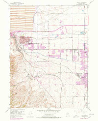
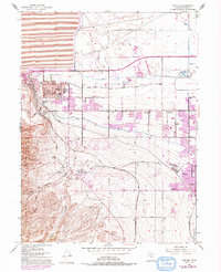
1952 Map of Magna
USGS Topo · Published 1975About this map
Magna Mill and the expansive Tailings Pond define the industrial footprint of this Salt Lake County landscape, where the foothills of the Oquirrh Mountains meet the valley floor. During this mid-century period, the area transitioned from a purely mining and agricultural corridor into a series of organized residential communities. Educational infrastructure is prominent, with Cyprus High Sch, Webster Sch, and Brockbank Jr HS serving the growing population of Magna. To the south, the industrial presence continues with the Bacchus settlement and a Powder Plant tucked into the slopes near Coon Canyon. The map reveals a complex web of transportation and water management, featuring the Denver and Rio Grande Western Railroad alongside major irrigation works like the Utah and Salt Lake Canal and Riter Canal.
Find a feature on this map
48 named features on this map. Tap any name to fly to it.
Don’t see what you’re looking for? This feature index may not catch every label — zoom into the map to look around manually.
Map Details
Editions of this 1952 Magna Map
6 editions found
Other maps of this area

1885 · Salt Lake
USGS Topo · 1:250,000

1885 · Tooele Valley
USGS Topo · 1:250,000

1925 · Ft. Douglas
USGS Topo · 1:125,000

1928 · Ft. Douglas
USGS Topo · 1:125,000

1951 · Saltair
USGS Topo · 1:24,000

1951 · Salt Lake City South
USGS Topo · 1:24,000

1951 · Midvale
USGS Topo · 1:24,000

1951 · Salt Lake City North
USGS Topo · 1:24,000

1952 · Magna
USGS Topo · 1:24,000

1952 · Bingham Canyon
USGS Topo · 1:24,000