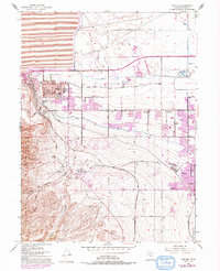
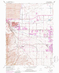
1952 Map of Magna
USGS Topo · Published 1993About this map
Industrial expansion and residential growth define this mid-century look at the eastern edge of the Oquirrh Mountains. The massive Tailings Pond and the Mining Railroad leading toward Bacchus highlight the heavy copper and mining infrastructure that fueled the local economy. At the same time, suburban patterns emerge in Magna and Hunter, anchored by educational hubs like Cyprus High Sch and Brockbank Jr HS.
Find a feature on this map
44 named features on this map. Tap any name to fly to it.
Don’t see what you’re looking for? This feature index may not catch every label — zoom into the map to look around manually.
Map Details
Editions of this 1952 Magna Map
6 editions found
Other maps of this area

1885 · Salt Lake
USGS Topo · 1:250,000

1885 · Tooele Valley
USGS Topo · 1:250,000

1925 · Ft. Douglas
USGS Topo · 1:125,000

1928 · Ft. Douglas
USGS Topo · 1:125,000

1951 · Saltair
USGS Topo · 1:24,000

1951 · Salt Lake City South
USGS Topo · 1:24,000

1951 · Midvale
USGS Topo · 1:24,000

1951 · Salt Lake City North
USGS Topo · 1:24,000

1952 · Magna
USGS Topo · 1:24,000

1952 · Bingham Canyon
USGS Topo · 1:24,000