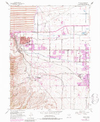
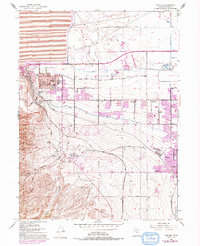
1952 Map of Magna
USGS Topo · Published 1987About this map
Industrial and residential expansion defines this landscape on the eastern slopes of the Oquirrh Mountains. The massive Magna Mill and its associated Tailings Pond dominate the northwestern corner, representing the copper processing power of the era. This activity is supported by a complex rail network, including the Union Pacific and several branches of the Utah and Denver Rio Grande Western Railroad, with specific industrial lines like the Bacchus Spur serving local facilities.
Find a feature on this map
45 named features on this map. Tap any name to fly to it.
Don’t see what you’re looking for? This feature index may not catch every label — zoom into the map to look around manually.
Map Details
Editions of this 1952 Magna Map
6 editions found
Other maps of this area

1885 · Salt Lake
USGS Topo · 1:250,000

1885 · Tooele Valley
USGS Topo · 1:250,000

1925 · Ft. Douglas
USGS Topo · 1:125,000

1928 · Ft. Douglas
USGS Topo · 1:125,000

1951 · Saltair
USGS Topo · 1:24,000

1951 · Salt Lake City South
USGS Topo · 1:24,000

1951 · Midvale
USGS Topo · 1:24,000

1951 · Salt Lake City North
USGS Topo · 1:24,000

1952 · Magna
USGS Topo · 1:24,000

1952 · Bingham Canyon
USGS Topo · 1:24,000