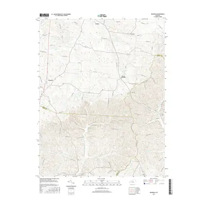
2016 Map of Magnolia
USGS Topo · Published 2016About this map
Magnolia and Buffalo anchor the northern reaches of this central Kentucky landscape, where the headwaters of multiple drainages create a complex network of ridges and hollows. The area is defined by its rural connectivity, with a dense grid of family-named routes such as J E Jones Rd and Ned Russel Rd linking disparate homesteads. This 2016 survey documents the enduring agricultural and residential patterns at the meeting point of Larue, Hart, and Green counties.
Find a feature on this map
81 named features on this map. Tap any name to fly to it.
Don’t see what you’re looking for? This feature index may not catch every label — zoom into the map to look around manually.
Map Details
Editions of this 2016 Magnolia Map
This is the sole edition of this map. No revisions or reprints were ever made.
Other maps of this area

1934 · Munfordville
USGS Topo · 1:48,000

1935 · Elizabethtown
USGS Topo · 1:48,000

1937 · Munfordville
USGS Topo · 1:62,500

1938 · Elizabethtown
USGS Topo · 1:62,500

1949 · Tonieville
USGS Topo · 1:24,000
1949 · Elizabethtown
USGS Topo · 1:62,500

1953 · Howardstown
USGS Topo · 1:24,000

1953 · Hudgins
USGS Topo · 1:24,000

1953 · Hibernia
USGS Topo · 1:24,000

1953 · Summersville
USGS Topo · 1:24,000