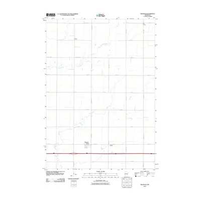
2010 Map of Magnolia
USGS Topo · Published 2010About this map
Magnolia sits at the intersection of a vast agricultural grid in Rock County, serving as the primary hub for this corner of the state. The landscape is defined by the winding paths of Champepadan Creek and Elk Creek, which cut across the rigid township and range lines. In the town itself, the Magnolia Post Office stands as a focal point of local identity, while the surrounding rural blocks contain several sites of genealogical interest. Three distinct burial grounds—Saint Marys Cemetery, Kenneth Cemetery, and Westside Cemetery—are preserved among the fields. The transportation network is a mixture of modern thoroughfares like Luverne St and established routes such as County Hwy-3, reflecting the enduring importance of road connectivity in this farming region during the early twenty-first century.
Find a feature on this map
24 named features on this map. Tap any name to fly to it.
Don’t see what you’re looking for? This feature index may not catch every label — zoom into the map to look around manually.
Map Details
Editions of this 2010 Magnolia Map
This is the sole edition of this map. No revisions or reprints were ever made.
Other maps of this area

1954 · Fairmont
USGS Topo · 1:250,000

1955 · Sioux Falls
USGS Topo · 1:250,000

1958 · Sioux Falls
USGS Topo · 1:250,000

1958 · Fairmont
USGS Topo · 1:250,000

1967 · Edgerton South
USGS Topo · 1:24,000

1967 · Slayton SW
USGS Topo · 1:24,000

1967 · Magnolia
USGS Topo · 1:24,000

1967 · Kenneth
USGS Topo · 1:24,000

1967 · Adrian SW
USGS Topo · 1:24,000

1967 · Adrian
USGS Topo · 1:24,000