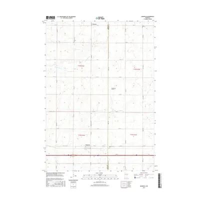
2016 Map of Magnolia
USGS Topo · Published 2016About this map
The Coteau des Prairies upland plateau forms the backdrop for this southwestern Minnesota agricultural landscape. Centered on the border of Rock and Nobles counties, the area is defined by the settlements of Magnolia and Kenneth, which serve as the primary hubs for this rural expanse. The map illustrates a strictly partitioned landscape where the rectilinear grid of township roads and range lines, such as Ahlers Ave and Birkett Ave, crosses the natural courses of Champepadan Cr and Elk Cr. This intersection of human planning and physical geography is most evident in the placement of community landmarks like Kenneth Cem, Saint Marys Cem, and Westside Cem, which sit at the quiet periphery of these established farming communities.
Find a feature on this map
42 named features on this map. Tap any name to fly to it.
Don’t see what you’re looking for? This feature index may not catch every label — zoom into the map to look around manually.
Map Details
Editions of this 2016 Magnolia Map
This is the sole edition of this map. No revisions or reprints were ever made.
Other maps of this area

1954 · Fairmont
USGS Topo · 1:250,000

1955 · Sioux Falls
USGS Topo · 1:250,000

1958 · Sioux Falls
USGS Topo · 1:250,000

1958 · Fairmont
USGS Topo · 1:250,000

1967 · Edgerton South
USGS Topo · 1:24,000

1967 · Slayton SW
USGS Topo · 1:24,000

1967 · Magnolia
USGS Topo · 1:24,000

1967 · Kenneth
USGS Topo · 1:24,000

1967 · Adrian SW
USGS Topo · 1:24,000

1967 · Adrian
USGS Topo · 1:24,000