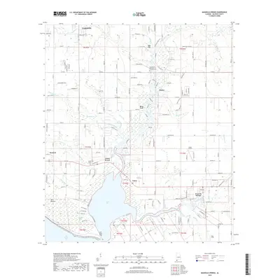
2018 Map of Magnolia Springs
USGS Topo · Published 2018About this map
Magnolia Springs and Clay City anchor this coastal Alabama landscape where the Fish River and Magnolia River converge into Weeks Bay. The geography is defined by a dense network of tributaries including Cowpen Creek, Waterhole Branch, and Weeks Creek, which carve through the lowlands south of Fairhope. The map documents a mix of established residential pockets and rural land, with local history preserved at sites like the Tinney South River Park Community Cem and the Brook Cedron Cem near Barnwell. The presence of Collier Airpark and Bass Field suggests the area's continued utility for light aviation. The drainage patterns of the Eslava Branch and Nottie Creek illustrate the hydrologic complexity of the Baldwin County interior, showing how the land transitions from the higher grounds of Marlow toward the wetlands of Bon Secour Bay.
Find a feature on this map
165 named features on this map. Tap any name to fly to it.
Don’t see what you’re looking for? This feature index may not catch every label — zoom into the map to look around manually.
Map Details
Editions of this 2018 Magnolia Springs Map
This is the sole edition of this map. No revisions or reprints were ever made.
Other maps of this area

1920 · Robertsdale
USGS Topo · 1:62,500

1921 · Bon Secour
USGS Topo · 1:62,500

1921 · Point Clear
USGS Topo · 1:62,500

1921 · Fairhope
USGS Topo · 1:62,500

1939 · Daphne
USGS Topo · 1:31,680

1940 · Silverhill
USGS Topo · 1:31,680

1941 · Daphne
USGS Topo · 1:31,680

1941 · Silverhill
USGS Topo · 1:31,680

1941 · Robertsdale
USGS Topo · 1:62,500

1941 · Foley
USGS Topo · 1:62,500