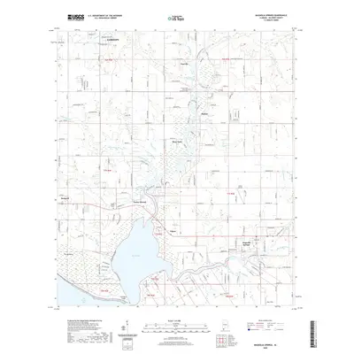
2020 Map of Magnolia Springs
USGS Topo · Published 2020About this map
Weeks Bay and the mouth of the Fish River dominate this coastal Baldwin County landscape, where the waters of the Magnolia River converge near the community of Magnolia Springs. The map documents a blend of established residential areas and riparian woodlands, with several small settlements such as Marlow, Yupon, and Clay City clustered along the riverbanks. The local geography is defined by a network of small tributaries including Eslava Br and Green Branch, which feed into the larger bay system. Local history is preserved in sites like the Timney South River Park Community Cem and Brook Cedron Cem near Turkey Branch. The presence of Collier Airpark and the southern edge of Fairhope illustrate the ongoing development of this region of the Alabama shoreline near Bon Secour Bay.
Find a feature on this map
151 named features on this map. Tap any name to fly to it.
Don’t see what you’re looking for? This feature index may not catch every label — zoom into the map to look around manually.
Map Details
Editions of this 2020 Magnolia Springs Map
This is the sole edition of this map. No revisions or reprints were ever made.
Other maps of this area

1920 · Robertsdale
USGS Topo · 1:62,500

1921 · Bon Secour
USGS Topo · 1:62,500

1921 · Point Clear
USGS Topo · 1:62,500

1921 · Fairhope
USGS Topo · 1:62,500

1939 · Daphne
USGS Topo · 1:31,680

1940 · Silverhill
USGS Topo · 1:31,680

1941 · Daphne
USGS Topo · 1:31,680

1941 · Silverhill
USGS Topo · 1:31,680

1941 · Robertsdale
USGS Topo · 1:62,500

1941 · Foley
USGS Topo · 1:62,500