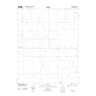
2012 Map of Magoun
USGS Topo · Published 2012About this map
Magoun sits at the southern edge of this High Plains landscape in Lipscomb County, where the grid of rural section roads meets the winding path of Ivanhoe Cr. This 2012 survey documents a sparsely populated ranching and agricultural region defined by its infrastructure, most notably the Follett/Lipscomb County Airport located along State Highway 15. The geography is marked by a precise network of county routes, such as Co Road G and Ranch Road 1454, which provide access to remote acreage and historical sites like Fairmont Cem. The map illustrates the characteristic Texas Panhandle pattern of straight-line survey boundaries contrasted against the erratic drainage of the local creeks, offering a clear record of land use and transportation near the Oklahoma border in the early 21st century.
Find a feature on this map
17 named features on this map. Tap any name to fly to it.
Don’t see what you’re looking for? This feature index may not catch every label — zoom into the map to look around manually.
Map Details
Editions of this 2012 Magoun Map
This is the sole edition of this map. No revisions or reprints were ever made.
Other maps of this area

1954 · Perryton
USGS Topo · 1:250,000

1955 · Woodward
USGS Topo · 1:250,000

1958 · Perryton
USGS Topo · 1:250,000

1958 · Woodward
USGS Topo · 1:250,000

1969 · Shattuck
USGS Topo · 1:24,000

1969 · Shattuck NW
USGS Topo · 1:24,000

1970 · Laverne SW
USGS Topo · 1:24,000

1971 · Logan
USGS Topo · 1:24,000

1971 · Slapout
USGS Topo · 1:24,000

1972 · Follett SE
USGS Topo · 1:24,000