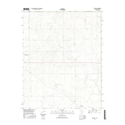
2016 Map of Magoun
USGS Topo · Published 2016About this map
The settlement of Magoun anchors the southern boundary of this High Plains landscape in Lipscomb County, where the terrain is defined by the winding course of Ivanhoe Cr. The map reveals a highly structured grid of section roads, including Co RD C and Co RD 28, which facilitate movement through the agricultural territory. Near the northern edge, the Fairmont Cem provides a point of genealogical interest, while the western corridor is served by the Follett/Lipscomb County Airport and FM 1454. This 2016 survey captures the rural character of the Texas-Oklahoma borderlands, showing how drainage patterns and transport networks like NS 169 influence the placement of regional infrastructure in this sparsely populated cattle and farming country.
Find a feature on this map
21 named features on this map. Tap any name to fly to it.
Don’t see what you’re looking for? This feature index may not catch every label — zoom into the map to look around manually.
Map Details
Editions of this 2016 Magoun Map
This is the sole edition of this map. No revisions or reprints were ever made.
Other maps of this area

1954 · Perryton
USGS Topo · 1:250,000

1955 · Woodward
USGS Topo · 1:250,000

1958 · Perryton
USGS Topo · 1:250,000

1958 · Woodward
USGS Topo · 1:250,000

1969 · Shattuck
USGS Topo · 1:24,000

1969 · Shattuck NW
USGS Topo · 1:24,000

1970 · Laverne SW
USGS Topo · 1:24,000

1971 · Logan
USGS Topo · 1:24,000

1971 · Slapout
USGS Topo · 1:24,000

1972 · Follett SE
USGS Topo · 1:24,000