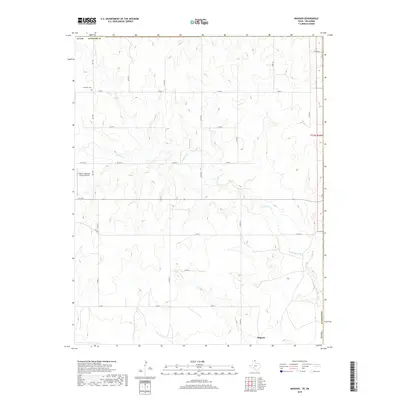
2019 Map of Magoun
USGS Topo · Published 2019About this map
The High Plains of the Texas Panhandle define the landscape in this northeastern corner of Lipscomb County. The tiny settlement of Magoun anchors the southern portion of the sheet, while the northern reaches are dominated by the winding drainage of Ivanhoe Creek. The terrain is characterized by the broad, flat plateaus typical of the region, dissected by the subtle draws of the creek system. Historical markers of the area's rural development are present, most notably the Fairmont Cemetery in the northwest, providing a point of interest for genealogists tracing local families. Transportation and infrastructure are represented by the Follett/Lipscomb County Airport and a grid-like network of county roads, including Co Rd 24 and Co Rd G, which facilitate movement across this expansive ranching and agricultural territory near the Oklahoma border.
Find a feature on this map
23 named features on this map. Tap any name to fly to it.
Don’t see what you’re looking for? This feature index may not catch every label — zoom into the map to look around manually.
Map Details
Editions of this 2019 Magoun Map
This is the sole edition of this map. No revisions or reprints were ever made.
Other maps of this area

1954 · Perryton
USGS Topo · 1:250,000

1955 · Woodward
USGS Topo · 1:250,000

1958 · Perryton
USGS Topo · 1:250,000

1958 · Woodward
USGS Topo · 1:250,000

1969 · Shattuck
USGS Topo · 1:24,000

1969 · Shattuck NW
USGS Topo · 1:24,000

1970 · Laverne SW
USGS Topo · 1:24,000

1971 · Logan
USGS Topo · 1:24,000

1971 · Slapout
USGS Topo · 1:24,000

1972 · Follett SE
USGS Topo · 1:24,000