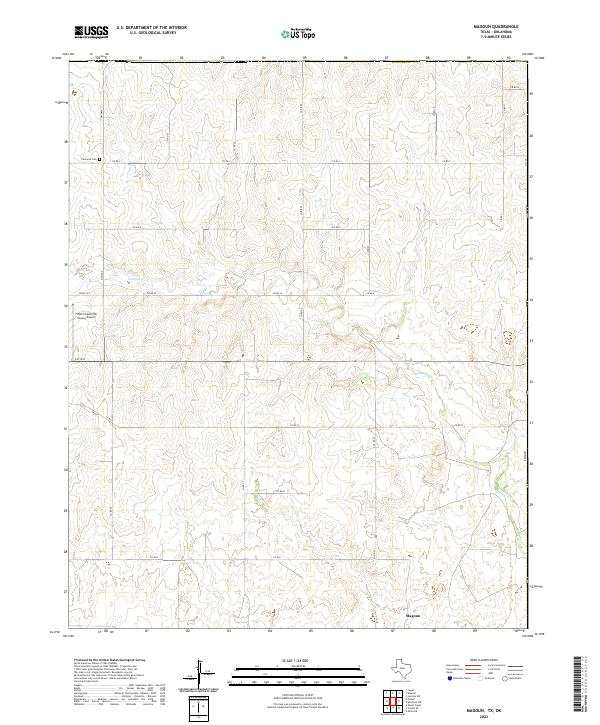
2022 Map of Magoun
USGS Topo · Published 2022About this map
Magoun sits at the heart of this high-plains landscape in the northeast corner of the Texas Panhandle. The terrain is defined by the winding course of Ivanhoe Cr, which carves subtle drainages through the agricultural lands of Lipscomb County. Local infrastructure is anchored by the Follett/Lipscomb County Airport in the western portion of the map, alongside a grid of rural county roads such as Co Rd 24 and Co Rd G. For those tracing family ties to the area, the Fairmont Cem provides a specific point of reference in the northwestern section, situated near Fm 1454. The map illustrates the sparsely populated, ranch-oriented character of this region where the Texas border meets Oklahoma, showing how transportation routes like Co RD 31 skirt the state line.
Find a feature on this map
24 named features on this map. Tap any name to fly to it.
Don’t see what you’re looking for? This feature index may not catch every label — zoom into the map to look around manually.
Map Details
Editions of this 2022 Magoun Map
This is the sole edition of this map. No revisions or reprints were ever made.
Other maps of this area

1954 · Perryton
USGS Topo · 1:250,000

1955 · Woodward
USGS Topo · 1:250,000

1958 · Perryton
USGS Topo · 1:250,000

1958 · Woodward
USGS Topo · 1:250,000

1969 · Shattuck
USGS Topo · 1:24,000

1969 · Shattuck NW
USGS Topo · 1:24,000

1970 · Laverne SW
USGS Topo · 1:24,000

1971 · Logan
USGS Topo · 1:24,000

1971 · Slapout
USGS Topo · 1:24,000

1972 · Follett SE
USGS Topo · 1:24,000