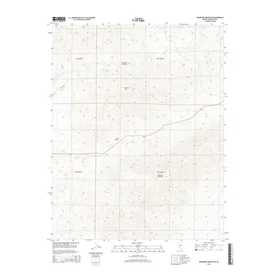
2014 Map of Magruder Mountain
USGS Topo · Published 2014About this map
Magruder Mountain dominates the high desert landscape of Esmeralda County in this 2014 survey, rising above a network of seasonal water sources and mountain passes. The terrain is defined by the Palmetto Mountains, including the prominent peak of Palmetto Mtn, where the elevation shifts drastically over short distances. This arid region relies on scattered water points such as Excelsior Spring, Indian Spring, and Kline Spring to sustain any activity in the area. Transportation through these elevations is anchored by the crossing at Lida Summit and the path of Highway 266. Drainage patterns, visible through Palmetto Wash and Lida Wash, trace the natural runoff routes from the peaks. The inclusion of Mammoth Springs and State Line Springs highlights the critical, sparse hydrography that has dictated land use and travel in this part of Nevada for generations.
Find a feature on this map
17 named features on this map. Tap any name to fly to it.
Don’t see what you’re looking for? This feature index may not catch every label — zoom into the map to look around manually.
Map Details
Editions of this 2014 Magruder Mountain Map
This is the sole edition of this map. No revisions or reprints were ever made.
Other maps of this area

1898 · Silver Peak
USGS Topo · 1:125,000

1900 · Silver Peak
USGS Topo · 1:125,000

1908 · Lida
USGS Topo · 1:250,000

1913 · Lida
USGS Topo · 1:250,000

1945 · Goldfield
USGS Topo · 1:125,000

1954 · Goldfield
USGS Topo · 1:250,000

1955 · Goldfield
USGS Topo · 1:250,000

1957 · Magruder Mtn
USGS Topo · 1:62,500

1958 · Goldfield
USGS Topo · 1:250,000

1962 · Goldfield
USGS Topo · 1:250,000