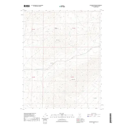
2018 Map of Magruder Mountain
USGS Topo · Published 2018About this map
Magruder Mtn and Palmetto Mtn dominate this high-elevation corner of Esmeralda County, where the topography is defined by the steep rises of the Palmetto Mountains. This landscape is fundamentally shaped by its water sources, essential for survival in the high desert. A series of natural springs, including Excelsior Spring, Indian Spring, and Mammoth Springs, are scattered throughout the peaks and washes, indicating the critical points of resource that would have dictated travel and activity in this region. The map shows the winding route of State Route 266 as it climbs toward Lida Summit before descending toward the Lida Valley. This passage through the mountains via Lida Wash and Palmetto Wash illustrates the primary corridor for movement between the basin floor and the rugged interior of the range near the California-Nevada border.
Find a feature on this map
16 named features on this map. Tap any name to fly to it.
Don’t see what you’re looking for? This feature index may not catch every label — zoom into the map to look around manually.
Map Details
Editions of this 2018 Magruder Mountain Map
This is the sole edition of this map. No revisions or reprints were ever made.
Other maps of this area

1898 · Silver Peak
USGS Topo · 1:125,000

1900 · Silver Peak
USGS Topo · 1:125,000

1908 · Lida
USGS Topo · 1:250,000

1913 · Lida
USGS Topo · 1:250,000

1945 · Goldfield
USGS Topo · 1:125,000

1954 · Goldfield
USGS Topo · 1:250,000

1955 · Goldfield
USGS Topo · 1:250,000

1957 · Magruder Mtn
USGS Topo · 1:62,500

1958 · Goldfield
USGS Topo · 1:250,000

1962 · Goldfield
USGS Topo · 1:250,000