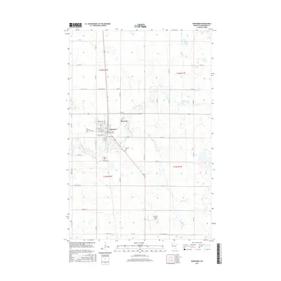
2016 Map of Mahnomen
USGS Topo · Published 2016About this map
Mahnomen serves as the focal point for this region of Mahnomen County, where the plains are etched by the winding courses of the Wild Rice River and the White Earth River. The town's grid is well-defined by a series of presidential avenues, including W Adams Ave and W Monroe Ave, supporting a community that includes the White Earth Tribal and Community Coll. This map documents a landscape deeply rooted in local heritage, with established sites such as First Lutheran Cem and Saint Michaels Cem appearing on the periphery of the settlement. To the northeast, the smaller community of Riverland sits near the riverbanks, while the southern reaches of the quadrangle are characterized by agricultural tracts and the Mahnomen County Airport. The hydrology of the area is further defined by Rush Lake and the drainage of Whiskey Cr across the eastern townships.
Find a feature on this map
35 named features on this map. Tap any name to fly to it.
Don’t see what you’re looking for? This feature index may not catch every label — zoom into the map to look around manually.
Map Details
Editions of this 2016 Mahnomen Map
This is the sole edition of this map. No revisions or reprints were ever made.
Other maps of this area

1918 · Flom
USGS Topo · 1:62,500

1952 · Grand Forks
USGS Topo · 1:250,000

1954 · Bemidji
USGS Topo · 1:250,000

1956 · Grand Forks
USGS Topo · 1:250,000

1957 · Bemidji
USGS Topo · 1:250,000

1958 · Bemidji
USGS Topo · 1:250,000

1966 · Grand Forks
USGS Topo · 1:250,000
1966 · Flom NE
USGS Topo · 1:24,000
1966 · Faith
USGS Topo · 1:24,000
1966 · Faith NE
USGS Topo · 1:24,000