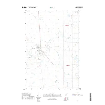
2019 Map of Mahnomen
USGS Topo · Published 2019About this map
Mahnomen serves as the focal point of this region, situated where several local routes converge in a landscape defined by the winding Wild Rice River. The town grid, featuring streets like W Adams Ave and E Jefferson Ave, is flanked by several significant burial grounds, including First Lutheran Cem to the northwest and Saint Michaels Cem to the south. The surrounding terrain is heavily influenced by glacial geography, evident in the numerous small wetlands and lakes like Rush Lake that dot the prairie-forest transition zone. Further south, the Mahnomen County Airport and the junction of the White Earth River and Whiskey Cr indicate a sparsely populated but active rural corridor. The small settlement of Riverland sits east of the main town, illustrating the clustered development patterns typical of this portion of Mahnomen County.
Find a feature on this map
40 named features on this map. Tap any name to fly to it.
Don’t see what you’re looking for? This feature index may not catch every label — zoom into the map to look around manually.
Map Details
Editions of this 2019 Mahnomen Map
This is the sole edition of this map. No revisions or reprints were ever made.
Other maps of this area

1918 · Flom
USGS Topo · 1:62,500

1952 · Grand Forks
USGS Topo · 1:250,000

1954 · Bemidji
USGS Topo · 1:250,000

1956 · Grand Forks
USGS Topo · 1:250,000

1957 · Bemidji
USGS Topo · 1:250,000

1958 · Bemidji
USGS Topo · 1:250,000

1966 · Grand Forks
USGS Topo · 1:250,000
1966 · Flom NE
USGS Topo · 1:24,000
1966 · Faith
USGS Topo · 1:24,000
1966 · Faith NE
USGS Topo · 1:24,000