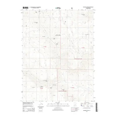
2014 Map of Mahogany Point
USGS Topo · Published 2014About this map
Manti-LaSal National Forest dominates this landscape, characterized by the high plateaus of Emery County. The topography is defined by significant elevations like Trail Mtn and East Mtn, which are dissected by numerous drainage systems including Cottonwood Cr and Grimes Wash. A notable human-interest landmark is the Coal Mining Monument Point of Interest, signifying the importance of the extractive industries in this region of Utah. The map detail highlights the complex network of canyons such as Dairy Canyon, Roans Canyon, and Meetinghouse Canyon, providing a clear view of the water sources that sustain the area, from Elk Spring to the high-elevation Snow Lake. The presence of named swales like Cox Swale and Reid and Nielson Swale indicates historical livestock or geographical references essential for local researchers.
Find a feature on this map
29 named features on this map. Tap any name to fly to it.
Don’t see what you’re looking for? This feature index may not catch every label — zoom into the map to look around manually.
Map Details
Editions of this 2014 Mahogany Point Map
This is the sole edition of this map. No revisions or reprints were ever made.
Other maps of this area

1885 · Manti
USGS Topo · 1:250,000

1895 · Manti
USGS Topo · 1:250,000

1922 · Wasatch
USGS Topo · 1:31,680

1923 · Castle Dale
USGS Topo · 1:62,500

1923 · Hiawatha
USGS Topo · 1:62,500

1925 · Castle Dale
USGS Topo · 1:62,500

1925 · Hiawatha
USGS Topo · 1:62,500

1956 · Price
USGS Topo · 1:250,000

1960 · Price
USGS Topo · 1:250,000

1962 · Price
USGS Topo · 1:250,000