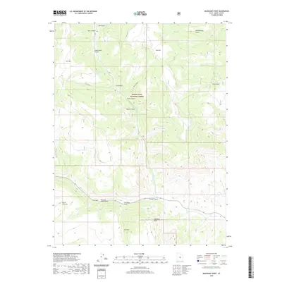
2020 Map of Mahogany Point
USGS Topo · Published 2020About this map
The Manti-La Sal National Forest dominates this section of the Wasatch Plateau, where high-altitude geography is defined by prominent landforms like Trail Mtn and East Mtn. This high country, situated in Emery County, serves as a vital drainage basin where numerous steep canyons, such as Indian Lodge Canyon and Meetinghouse Canyon, descend toward the lower valleys. The inclusion of the Ccc Trail - Trail Mtn indicates a landscape shaped by early 20th-century public works, providing access through difficult terrain. To the south, the topography transitions toward North Horn Mtn and features distinct local landmarks such as the Clay Banks and the prominent Mahogany Point. Significant water management and stock features are evident in the naming of Reid and Nielson Swale and Cox Swale, alongside Snow Lake, reflecting the region's agricultural and grazing history.
Find a feature on this map
26 named features on this map. Tap any name to fly to it.
Don’t see what you’re looking for? This feature index may not catch every label — zoom into the map to look around manually.
Map Details
Editions of this 2020 Mahogany Point Map
This is the sole edition of this map. No revisions or reprints were ever made.
Other maps of this area

1885 · Manti
USGS Topo · 1:250,000

1895 · Manti
USGS Topo · 1:250,000

1922 · Wasatch
USGS Topo · 1:31,680

1923 · Castle Dale
USGS Topo · 1:62,500

1923 · Hiawatha
USGS Topo · 1:62,500

1925 · Castle Dale
USGS Topo · 1:62,500

1925 · Hiawatha
USGS Topo · 1:62,500

1956 · Price
USGS Topo · 1:250,000

1960 · Price
USGS Topo · 1:250,000

1962 · Price
USGS Topo · 1:250,000