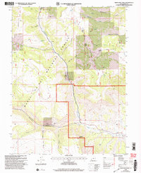
2001 Map of Mahogany Point
USGS Topo · Published 2004About this map
East Mountain and the canyon-cut plateaus of the Manti-La Sal National Forest define this 2001 revision, highlighting an era of active resource extraction in Emery County. Industrial activity is concentrated along the steep walls of Straight Canyon, where the Trail Mountain Mine, Oliphant Mine, and Black Diamond Mine are positioned near a prominent Mine Monument. The map documents the complex topography of high-altitude drainages like Cottonwood Creek and Grimes Wash, which are fed by numerous high-country water sources such as Snow Lake and North Point Spring.
Find a feature on this map
35 named features on this map. Tap any name to fly to it.
Don’t see what you’re looking for? This feature index may not catch every label — zoom into the map to look around manually.
Map Details
Editions of this 2001 Mahogany Point Map
This is the sole edition of this map. No revisions or reprints were ever made.
Other maps of this area

1885 · Manti
USGS Topo · 1:250,000

1895 · Manti
USGS Topo · 1:250,000

1922 · Wasatch
USGS Topo · 1:31,680

1923 · Castle Dale
USGS Topo · 1:62,500

1923 · Hiawatha
USGS Topo · 1:62,500

1925 · Castle Dale
USGS Topo · 1:62,500

1925 · Hiawatha
USGS Topo · 1:62,500

1956 · Price
USGS Topo · 1:250,000

1960 · Price
USGS Topo · 1:250,000

1962 · Price
USGS Topo · 1:250,000