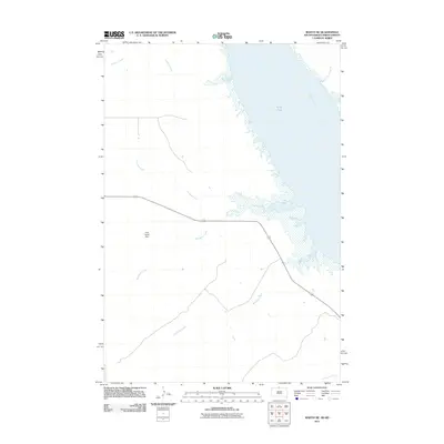
2011 Map of Mahto NE
USGS Topo · Published 2011About this map
The Missouri River defines the eastern edge of this landscape, its waters backing into the wide lowlands of Kenel Flats. This 2011 survey of the Kenel District reveals a vast drainage network where numerous named seasonal and permanent streams flow toward the river valley. The water management of the area is highlighted by the Fred Hertel Dam, which controls the flow of Blackfoot Creek. The terrain is further etched by the paths of Fireheart Creek, Joe Bush Creek, and Baldhead Creek, while Hunkpapa Creek cuts across the southern reach. The map illustrates a contemporary rural environment where local water resources and geography remain the primary features of the land's organization.
Find a feature on this map
8 named features on this map. Tap any name to fly to it.
Don’t see what you’re looking for? This feature index may not catch every label — zoom into the map to look around manually.
Map Details
Editions of this 2011 Mahto NE Map
This is the sole edition of this map. No revisions or reprints were ever made.
Other maps of this area

1953 · McIntosh
USGS Topo · 1:250,000

1954 · Bismarck
USGS Topo · 1:250,000

1958 · Bismarck
USGS Topo · 1:250,000

1958 · McIntosh
USGS Topo · 1:250,000

1966 · Mahto NE
USGS Topo · 1:24,000

1966 · Mahto
USGS Topo · 1:24,000

1966 · Kenel
USGS Topo · 1:24,000

1966 · Mahto NW
USGS Topo · 1:24,000

1966 · Kline Buttes
USGS Topo · 1:24,000

1966 · Pollock NW
USGS Topo · 1:24,000