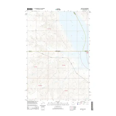
2015 Map of Mahto NE
USGS Topo · Published 2015About this map
Missouri River waters dominate the eastern reach of this landscape, forming the expansive Lake Oahe reservoir along the border of North Dakota and South Dakota. This 2015 survey illustrates the modern topography of the Standing Rock region, where the high plains are deeply incised by a network of drainage systems. Numerous creeks, including Fireheart Cr, Joe Bush Cr, Blackfoot Cr, and Baldhead Cr, carve through the rolling terrain as they move toward the Missouri basin. The road network is primarily composed of rural routes like Bia Rd 3 and 100th St SW, reflecting the sparse settlement pattern and agricultural character of Corson County and Sioux County. The map provides a precise view of the land partitions and tribal road systems near the confluence of Hunkpapa Cr and the reservoir.
Find a feature on this map
23 named features on this map. Tap any name to fly to it.
Don’t see what you’re looking for? This feature index may not catch every label — zoom into the map to look around manually.
Map Details
Editions of this 2015 Mahto NE Map
This is the sole edition of this map. No revisions or reprints were ever made.
Other maps of this area

1953 · McIntosh
USGS Topo · 1:250,000

1954 · Bismarck
USGS Topo · 1:250,000

1958 · Bismarck
USGS Topo · 1:250,000

1958 · McIntosh
USGS Topo · 1:250,000

1966 · Mahto NE
USGS Topo · 1:24,000

1966 · Mahto
USGS Topo · 1:24,000

1966 · Kenel
USGS Topo · 1:24,000

1966 · Mahto NW
USGS Topo · 1:24,000

1966 · Kline Buttes
USGS Topo · 1:24,000

1966 · Pollock NW
USGS Topo · 1:24,000