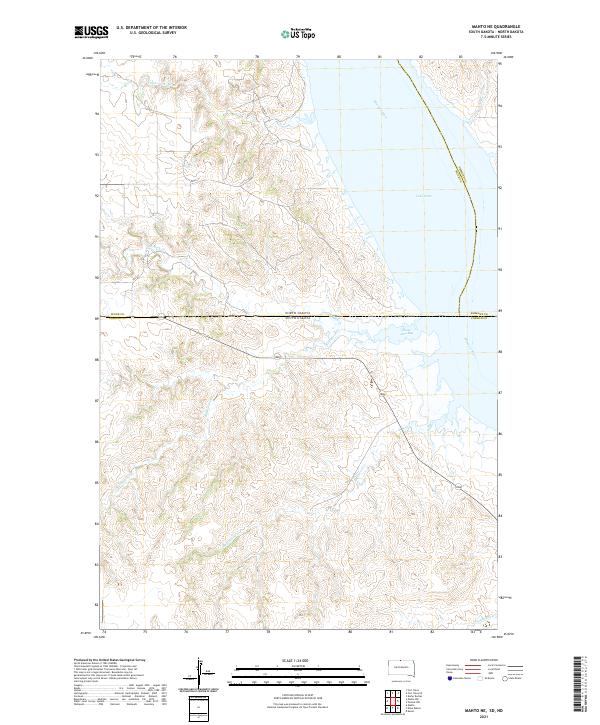
2021 Map of Mahto NE
USGS Topo · Published 2021About this map
Missouri River and Lake Oahe define the eastern edge of this landscape at the border of North and South Dakota. The topography is dominated by the intricate drainages feeding into the reservoir, including the winding paths of Fireheart Cr and Joe Bush Cr in the north, and Blackfoot Cr which cuts through the central sections. These waterways are tied to the surrounding tribal lands, with names like Hunkpapa Cr reflecting the cultural heritage of the Standing Rock region.
Find a feature on this map
21 named features on this map. Tap any name to fly to it.
Don’t see what you’re looking for? This feature index may not catch every label — zoom into the map to look around manually.
Map Details
Editions of this 2021 Mahto NE Map
This is the sole edition of this map. No revisions or reprints were ever made.
Other maps of this area

1953 · McIntosh
USGS Topo · 1:250,000

1954 · Bismarck
USGS Topo · 1:250,000

1958 · Bismarck
USGS Topo · 1:250,000

1958 · McIntosh
USGS Topo · 1:250,000

1966 · Mahto NE
USGS Topo · 1:24,000

1966 · Mahto
USGS Topo · 1:24,000

1966 · Kenel
USGS Topo · 1:24,000

1966 · Mahto NW
USGS Topo · 1:24,000

1966 · Kline Buttes
USGS Topo · 1:24,000

1966 · Pollock NW
USGS Topo · 1:24,000