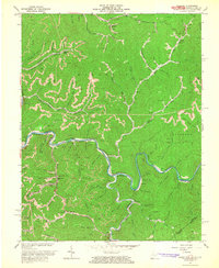
1964 Map of Majestic
USGS Topo · Published 1965About this map
Tug Fork carves a winding path through the heart of this Central Appalachian coal country, serving as the definitive border between West Virginia and Kentucky. The landscape is defined by the heavy presence of the Norfolk and Western railway, which tracks the river's tight bends to serve a series of isolated mountain communities. Industrial activity is concentrated at the Thacker Mines and various Strip Mine operations that pepper the high ridges of Magnolia and Stafford districts. Small settlements like Majestic, Devon, and Vulcan are tucked into the narrow valleys, often centered around the rail line. Local education and community life are anchored by several rural institutions, including Thacker Sch, Beech Creek Sch, and Turkey Fork Sch, reflecting the decentralized settlement pattern dictated by the steep, stream-dissected terrain.
Find a feature on this map
69 named features on this map. Tap any name to fly to it.
Don’t see what you’re looking for? This feature index may not catch every label — zoom into the map to look around manually.
Map Details
Editions of this 1964 Majestic Map
3 editions found
Other maps of this area

1886 · Grundy
USGS Topo · 1:125,000

1887 · Warfield
USGS Topo · 1:125,000

1890 · Grundy
USGS Topo · 1:125,000

1891 · Tazewell
USGS Topo · 1:125,000

1891 · Oceana
USGS Topo · 1:125,000

1891 · Warfield
USGS Topo · 1:125,000

1892 · Grundy
USGS Topo · 1:125,000

1893 · Oceana
USGS Topo · 1:125,000

1895 · Tazewell
USGS Topo · 1:125,000

1897 · Tazewell
USGS Topo · 1:125,000