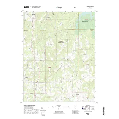
2018 Map of Makanda
USGS Topo · Published 2018About this map
Makanda and Cobden sit at the northern edge of the Shawnee National Forest in this modern topographic survey, where the rugged terrain of southern Illinois transitions from the high ground of Tiptop Knob to the bottomlands of the Cache River. The landscape is densely marked by nineteenth-century family burial grounds and community landmarks, reflecting a deep genealogical record across Jackson and Union counties. Noteworthy sites include Stone Fort and the Saratoga Cemetery, alongside numerous smaller plots like the Lockard Cemetery and Zimmerman Cemetery.
Find a feature on this map
80 named features on this map. Tap any name to fly to it.
Don’t see what you’re looking for? This feature index may not catch every label — zoom into the map to look around manually.
Map Details
Editions of this 2018 Makanda Map
This is the sole edition of this map. No revisions or reprints were ever made.
Other maps of this area

1920 · Jonesboro
USGS Topo · 1:62,500

1920 · Dongola
USGS Topo · 1:62,500

1922 · Carbondale
USGS Topo · 1:62,500

1923 · Dongola
USGS Topo · 1:62,500

1923 · Jonesboro
USGS Topo · 1:62,500

1924 · Alto Pass
USGS Topo · 1:62,500

1941 · Carbondale
USGS Topo · 1:62,500

1947 · Jonesboro
USGS Topo · 1:62,500

1947 · Alto Pass
USGS Topo · 1:62,500
1947 · Cobden
USGS Topo · 1:24,000