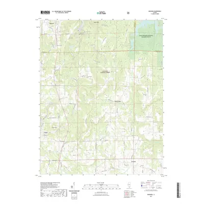
2021 Map of Makanda
USGS Topo · Published 2021About this map
Makanda and Cobden anchor this 2021 study of the southern Illinois landscape, where the northern reaches of the Shawnee National Forest meet the southern edge of the Crab Orchard National Wildlife Refuge. The map provides a detailed view of the rural transition from the rugged highlands of Tiptop Knob down to the southern drainage basins of the Cache River. Dozens of family-named cemeteries and landmarks are preserved here, including Evergreen Cem, Walker Cem, and Sitter Cem, offering clear coordinates for genealogists tracing local lineage. The road network, including Old US Hwy 51 and the winding Water Valley Rd, highlights the complex topography that has historically defined settlement patterns in this part of Union and Jackson Counties.
Find a feature on this map
48 named features on this map. Tap any name to fly to it.
Don’t see what you’re looking for? This feature index may not catch every label — zoom into the map to look around manually.
Map Details
Editions of this 2021 Makanda Map
This is the sole edition of this map. No revisions or reprints were ever made.
Other maps of this area

1920 · Jonesboro
USGS Topo · 1:62,500

1920 · Dongola
USGS Topo · 1:62,500

1922 · Carbondale
USGS Topo · 1:62,500

1923 · Dongola
USGS Topo · 1:62,500

1923 · Jonesboro
USGS Topo · 1:62,500

1924 · Alto Pass
USGS Topo · 1:62,500

1941 · Carbondale
USGS Topo · 1:62,500

1947 · Jonesboro
USGS Topo · 1:62,500

1947 · Alto Pass
USGS Topo · 1:62,500
1947 · Cobden
USGS Topo · 1:24,000