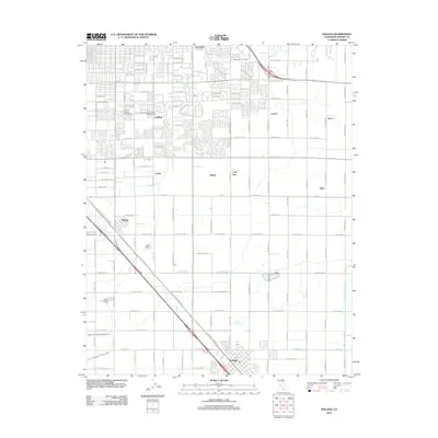
2012 Map of Malaga
USGS Topo · Published 2012About this map
Fowler and Sunnyside anchor this survey of the San Joaquin Valley’s agricultural and academic landscape. The map details the organized grid of the Fresno area, where industrial and educational sites like Fresno Pacific University sit alongside the extensive irrigation infrastructure that supports the region's productivity. A network of canals, including the Fancher Cr Canal, the North Branch Oleander Canal, and the Fowler Switch Canal, cuts through the valley floor, highlighting the critical role of water management in this horticultural hub. Small settlements and named locales such as Goldleaf, Locans, and Malaga are interspersed between large-scale research facilities like the United States Dept Agriculture Horticultural station. The geography is further defined by the transit corridor of S Golden State Blvd, which parallels several smaller rail and road routes connecting these disparate farming and residential communities.
Find a feature on this map
76 named features on this map. Tap any name to fly to it.
Don’t see what you’re looking for? This feature index may not catch every label — zoom into the map to look around manually.
Map Details
Editions of this 2012 Malaga Map
This is the sole edition of this map. No revisions or reprints were ever made.
Other maps of this area

1921 · Bullard
USGS Topo · 1:31,680

1922 · Round Mountain
USGS Topo · 1:31,680

1923 · Malaga
USGS Topo · 1:31,680

1923 · Fresno
USGS Topo · 1:31,680

1923 · Clovis
USGS Topo · 1:31,680

1923 · Sanger
USGS Topo · 1:31,680

1923 · Bullard
USGS Topo · 1:31,680

1924 · Selma
USGS Topo · 1:31,680

1924 · Conejo
USGS Topo · 1:31,680

1925 · Caruthers
USGS Topo · 1:31,680