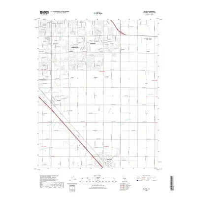
2018 Map of Malaga
USGS Topo · Published 2018About this map
The agricultural heart of the San Joaquin Valley is defined by a dense grid of irrigation channels and established communities southeast of Fresno. This 2018 survey illustrates the complex water management network essential to the region, featuring an intricate system of canals such as the Washington Colony Canal, Oleander Canal, and Fowler Switch Canal. These waterways intersect a landscape of citrus groves and vineyards, weaving through historic agricultural hubs like Malaga, Calwa, and Lone Star. In the northern portion of the map, institutional landmarks like the Mennonite Brethren Biblical Seminary and Fresno Pacific Univ mark the outward growth of the urban core into Sunnyside. To the south, the city of Fowler sits along the S Golden State Blvd corridor, illustrating the long-standing relationship between transportation routes and the valley's development.
Find a feature on this map
49 named features on this map. Tap any name to fly to it.
Don’t see what you’re looking for? This feature index may not catch every label — zoom into the map to look around manually.
Map Details
Editions of this 2018 Malaga Map
This is the sole edition of this map. No revisions or reprints were ever made.
Other maps of this area

1921 · Bullard
USGS Topo · 1:31,680

1922 · Round Mountain
USGS Topo · 1:31,680

1923 · Malaga
USGS Topo · 1:31,680

1923 · Fresno
USGS Topo · 1:31,680

1923 · Clovis
USGS Topo · 1:31,680

1923 · Sanger
USGS Topo · 1:31,680

1923 · Bullard
USGS Topo · 1:31,680

1924 · Selma
USGS Topo · 1:31,680

1924 · Conejo
USGS Topo · 1:31,680

1925 · Caruthers
USGS Topo · 1:31,680