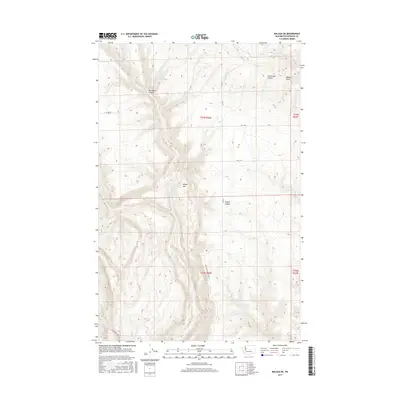
2017 Map of Malaga NE
USGS Topo · Published 2017About this map
Badger Mtn dominates this high-plateau landscape in Douglas County, where the terrain is deeply incised by a series of drainage systems. The map details a complex network of coulees and canyons, most notably Bevington Canyon and Sutherland Canyon in the northern reaches, and Francis Canyon to the south. Water sources are scarce but critical to this arid environment, evidenced by named points such as Robinson Spring and Luehm Spring.
Find a feature on this map
19 named features on this map. Tap any name to fly to it.
Don’t see what you’re looking for? This feature index may not catch every label — zoom into the map to look around manually.
Map Details
Editions of this 2017 Malaga NE Map
This is the sole edition of this map. No revisions or reprints were ever made.
Other maps of this area

1901 · Chelan
USGS Topo · 1:125,000

1912 · Malaga
USGS Topo · 1:48,000

1914 · Malaga
USGS Topo · 1:62,500

1920 · Colockum Pass
USGS Topo · 1:125,000

1922 · Colockum Pass
USGS Topo · 1:125,000

1953 · Ritzville
USGS Topo · 1:250,000

1957 · Wenatchee
USGS Topo · 1:250,000

1959 · Ritzville
USGS Topo · 1:250,000

1965 · Ritzville
USGS Topo · 1:250,000
1966 · Palisades
USGS Topo · 1:24,000