
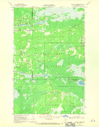
1918 Map of Malcolm
USGS Topo · Published 1918About this map
Thief River headwaters and a massive network of artificial drainage channels define this landscape in Northern Minnesota just after the First World War. Compiled by the Corps of Engineers U. S. Army, the survey details the systematic reclamation of wetlands through features like Main Judicial Ditch No. 21 and Jud. Ditch No. 11. These engineering efforts transformed the timber and swamp limits of the Ceded Chippewa Lands 1908, opening territory for settlements like Malcolm, Orheim, and Carmel. Local civic life is anchored at the Town Hall in Carmel and a scattered School house, while State Road No. 5 provides a primary terrestrial link through the township of Steenerson. The map captures a specific transition as the region moved from natural wilderness to an organized agricultural grid, marked by large timbered tracts and expansive openings.
Find a feature on this map
23 named features on this map. Tap any name to fly to it.
Don’t see what you’re looking for? This feature index may not catch every label — zoom into the map to look around manually.
Map Details
Editions of this 1918 Malcolm Map
This is the sole edition of this map. No revisions or reprints were ever made.
Other maps of this area

1918 · Winterroad
USGS Topo · 1:62,500

1918 · F
USGS Topo · 1:62,500

1918 · Pencer
USGS Topo · 1:62,500

1918 · Jelle
USGS Topo · 1:62,500

1919 · Liner
USGS Topo · 1:62,500

1954 · Roseau
USGS Topo · 1:250,000

1957 · Roseau
USGS Topo · 1:250,000

1958 · Roseau
USGS Topo · 1:250,000

1968 · Mulligan Lake SW
USGS Topo · 1:24,000
1968 · Mulligan Lake
USGS Topo · 1:24,000