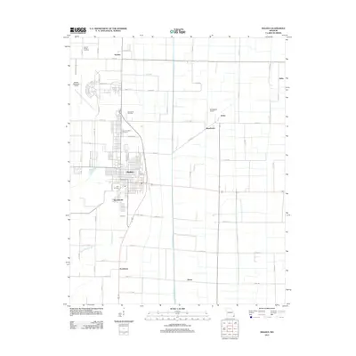
2012 Map of Malden
USGS Topo · Published 2012About this map
Malden serves as the central hub of this agricultural landscape, where the town's residential grid meets a vast network of drainage infrastructure essential to the region's productivity. The intricate system of man-made waterways, including Ditch Number 2 and Ditch Number 16, illustrates the extensive land reclamation efforts that transformed this corner of Missouri. Settlement patterns follow the cardinal directions of the local road system, connecting outlying communities such as Townley and Providence. Aviation history and utility are prominent features, with both the Malden Municipal Airport and the smaller Broadwater Airport serving the area. Local family and community history is anchored by several burial grounds, from the centrally located Park Cemetery and Memorial Park Cemetery to the outlying Stevens Chapel Cemetery and Macedonia Cemetery, providing a clear geography for genealogical research in Dunklin County.
Find a feature on this map
72 named features on this map. Tap any name to fly to it.
Don’t see what you’re looking for? This feature index may not catch every label — zoom into the map to look around manually.
Map Details
Editions of this 2012 Malden Map
This is the sole edition of this map. No revisions or reprints were ever made.
Other maps of this area

1940 · Malden
USGS Topo · 1:62,500

1940 · Pascola
USGS Topo · 1:62,500

1940 · Valley Ridge
USGS Topo · 1:62,500

1940 · Piggott
USGS Topo · 1:62,500

1955 · Pascola
USGS Topo · 1:62,500

1956 · Valley Ridge
USGS Topo · 1:62,500

1956 · Piggott
USGS Topo · 1:62,500

1956 · Malden
USGS Topo · 1:62,500

1956 · Dyersburg
USGS Topo · 1:250,000

1957 · Poplar Bluff
USGS Topo · 1:250,000