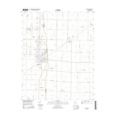
2015 Map of Malden
USGS Topo · Published 2015About this map
Malden and its surrounding agricultural landscape dominate this portion of the Missouri Bootheel, revealing a complex network of drainage ditches essential to the region's productive farmland. The town's layout is clearly defined, with Spoonerville and Providence sitting to the south along the transportation corridors that link these communities. This 2015 survey highlights the continued significance of aviation in the area, marked by the extensive Malden Regional Airport and the smaller Broadwater Airport to the east.
Find a feature on this map
113 named features on this map. Tap any name to fly to it.
Don’t see what you’re looking for? This feature index may not catch every label — zoom into the map to look around manually.
Map Details
Editions of this 2015 Malden Map
This is the sole edition of this map. No revisions or reprints were ever made.
Other maps of this area

1940 · Malden
USGS Topo · 1:62,500

1940 · Pascola
USGS Topo · 1:62,500

1940 · Valley Ridge
USGS Topo · 1:62,500

1940 · Piggott
USGS Topo · 1:62,500

1955 · Pascola
USGS Topo · 1:62,500

1956 · Valley Ridge
USGS Topo · 1:62,500

1956 · Piggott
USGS Topo · 1:62,500

1956 · Malden
USGS Topo · 1:62,500

1956 · Dyersburg
USGS Topo · 1:250,000

1957 · Poplar Bluff
USGS Topo · 1:250,000