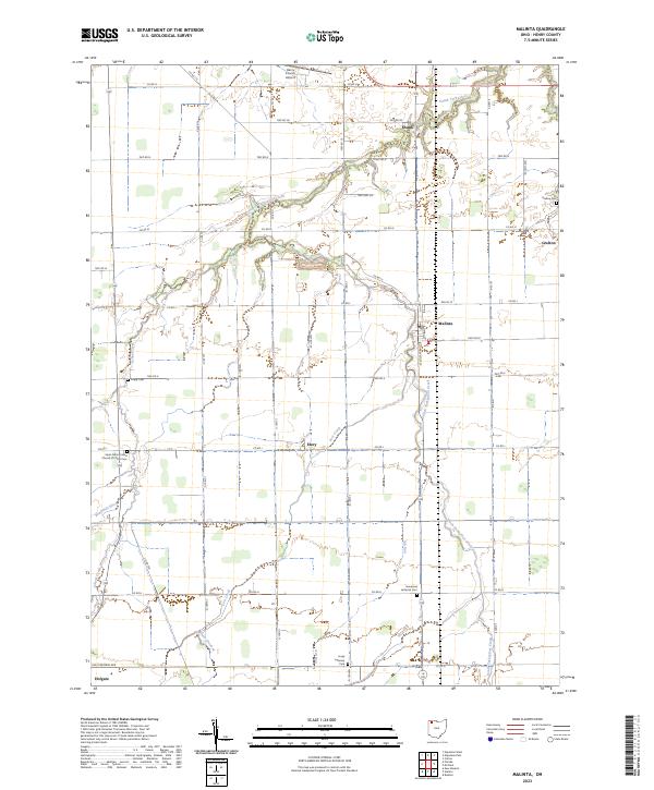
2023 Map of Malinta
USGS Topo · Published 2023About this map
South Turkeyfoot Creek meanders through this portion of Henry County, anchoring a landscape defined by small crossroads settlements and a strict grid of section roads. The village of Malinta sits near the center, while smaller communities like Shunk, Grelton, and Elery mark the intersections of the rural landscape. This area maintains a strong connection to its local heritage through numerous denominational burial grounds, including the Saint Johns United Church of Christ Cem and Immanuel Lutheran Cem.
Find a feature on this map
54 named features on this map. Tap any name to fly to it.
Don’t see what you’re looking for? This feature index may not catch every label — zoom into the map to look around manually.
Map Details
Editions of this 2023 Malinta Map
This is the sole edition of this map. No revisions or reprints were ever made.
Other maps of this area

1908 · Ottawa
USGS Topo · 1:62,500

1908 · Napoleon
USGS Topo · 1:62,500

1909 · Mc Clure
USGS Topo · 1:62,500

1953 · Fort Wayne
USGS Topo · 1:250,000

1956 · Fort Wayne
USGS Topo · 1:250,000

1956 · Toledo
USGS Topo · 1:250,000

1959 · Florida
USGS Topo · 1:24,000
1959 · Napoleon West
USGS Topo · 1:24,000

1960 · Deshler
USGS Topo · 1:24,000
1960 · Napoleon East
USGS Topo · 1:24,000