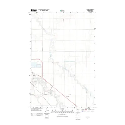
2013 Map of Mallory
USGS Topo · Published 2013About this map
The confluence of the Red Lake River and the winding Grand Marais Creek shapes the geography of this Red River Valley corridor during the early 21st century. The map highlights the southeastern edge of East Grand Forks, showing a transition from dense urban street grids like 8th St SE to the expansive agricultural landscape of Polk County. The terrain is characterized by intricate drainage systems, including the formally engineered County Ditch Number One Hundred Twentysix, which underscores the region's historical reliance on water management for its fertile farmland. To the southeast, the small settlement of Mallory sits along the Us-2 and MN-220 transit corridor, which cuts diagonally across the township lines. Local landmarks such as Resthaven Memorial Gardens provide specific points of interest for genealogists and local historians tracing the development of this border region.
Find a feature on this map
26 named features on this map. Tap any name to fly to it.
Don’t see what you’re looking for? This feature index may not catch every label — zoom into the map to look around manually.
Map Details
Editions of this 2013 Mallory Map
This is the sole edition of this map. No revisions or reprints were ever made.
Other maps of this area

1918 · Warren
USGS Topo · 1:62,500

1934 · Grand Forks
USGS Topo · 1:24,000

1934 · Grand Forks
USGS Topo · 1:62,500

1938 · Grand Forks
USGS Topo · 1:62,500

1952 · Grand Forks
USGS Topo · 1:250,000

1952 · Thief River Falls
USGS Topo · 1:250,000

1955 · Warren
USGS Topo · 1:62,500

1956 · Thief River Falls
USGS Topo · 1:250,000

1956 · Grand Forks
USGS Topo · 1:250,000

1957 · Thief River Falls
USGS Topo · 1:250,000