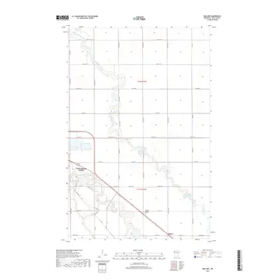
2019 Map of Mallory
USGS Topo · Published 2019About this map
The agricultural plains of Polk County are defined by the winding course of the Red Lake River as it approaches the eastern edge of East Grand Forks. This landscape illustrates the intersection of natural drainage and human engineering, where Grand Marais Creek meanders through the terrain alongside straight-cut water management projects like County Ditch Number One Hundred Twenty six. The settlement of Mallory anchors the southeastern portion of the quadrangle, situated along a network of county highways that trace the section lines of the Public Land Survey System. Local history and genealogy interest is centered around Resthaven Memorial Gardens and the residential growth extending from the city center, including corridors like Bygland Rd SE and Hartsville Rd.
Find a feature on this map
43 named features on this map. Tap any name to fly to it.
Don’t see what you’re looking for? This feature index may not catch every label — zoom into the map to look around manually.
Map Details
Editions of this 2019 Mallory Map
This is the sole edition of this map. No revisions or reprints were ever made.
Other maps of this area

1918 · Warren
USGS Topo · 1:62,500

1934 · Grand Forks
USGS Topo · 1:24,000

1934 · Grand Forks
USGS Topo · 1:62,500

1938 · Grand Forks
USGS Topo · 1:62,500

1952 · Grand Forks
USGS Topo · 1:250,000

1952 · Thief River Falls
USGS Topo · 1:250,000

1955 · Warren
USGS Topo · 1:62,500

1956 · Thief River Falls
USGS Topo · 1:250,000

1956 · Grand Forks
USGS Topo · 1:250,000

1957 · Thief River Falls
USGS Topo · 1:250,000