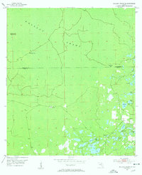
1954 Map of Mallory Swamp SE
USGS Topo · Published 1955About this map
Mallory Swamp dominates this remote stretch of Florida territory at the mid-century, straddling the boundary line between Lafayette and Dixie Counties. The landscape is a complex mosaic of wet prairies, bays, and hammocks, including the curiously named Deserters Hammock in the northwest. While much of the terrain is characterized by inaccessible wetlands, human activity is marked by seasonal or utilitarian outposts such as McElvain Camp and Cow Camp.
Find a feature on this map
22 named features on this map. Tap any name to fly to it.
Don’t see what you’re looking for? This feature index may not catch every label — zoom into the map to look around manually.
Map Details
Editions of this 1954 Mallory Swamp SE Map
3 editions found
Other maps of this area

1954 · Mallory Swamp NW
USGS Topo · 1:24,000

1954 · Cross City West
USGS Topo · 1:24,000

1954 · Cross City East
USGS Topo · 1:24,000

1954 · Mallory Swamp SW
USGS Topo · 1:24,000

1954 · Mallory Swamp SE
USGS Topo · 1:24,000

1954 · Mallory Swamp NE
USGS Topo · 1:24,000

1954 · Gainesville
USGS Topo · 1:250,000
1956 · Mallory Swamp NW
USGS Topo · 1:25,000

1956 · Mallory Swamp SE
USGS Topo · 1:25,000

1958 · Gainesville
USGS Topo · 1:250,000