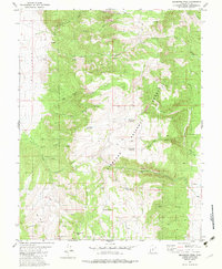
1980 Map of Malmsten Peak
USGS Topo · Published 1983About this map
Fishlake National Forest encompasses the high-altitude terrain of the Sevier Plateau shown in this early 1980s survey. The landscape is defined by the prominent Malmsten Peak and the southern slopes of Forshea Mountain, where a complex system of water management is evident through numerous upland catchments. Small bodies of water such as Hell Hole Reservoir, Tuft Reservoir, and Dead Horse Reservoir are connected by a network of seasonal drainages including Swift Spring Creek and Cottonwood Creek.
Find a feature on this map
33 named features on this map. Tap any name to fly to it.
Don’t see what you’re looking for? This feature index may not catch every label — zoom into the map to look around manually.
Map Details
Editions of this 1980 Malmsten Peak Map
2 editions found
Other maps of this area

1885 · Beaver
USGS Topo · 1:250,000

1885 · Fish Lake
USGS Topo · 1:250,000

1896 · Fish Lake
USGS Topo · 1:250,000

1945 · Marysvale
USGS Topo · 1:62,500

1947 · Marysvale
USGS Topo · 1:62,500

1953 · Richfield
USGS Topo · 1:250,000

1956 · Salina
USGS Topo · 1:250,000

1958 · Richfield
USGS Topo · 1:250,000

1960 · Salina
USGS Topo · 1:250,000

1962 · Salina
USGS Topo · 1:250,000