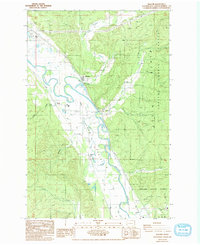
1986 Map of Malone
USGS Topo · Published 1993About this map
The Chehalis River winds through a complex landscape of lowland prairies and timberlands in this 1980s era survey. The river's serpentine course defines the central valley, where the small settlements of Malone and Porter are established along the transport corridor between the flanking highlands. To the east, the rising terrain is dominated by the Black Hills State Forest and Capitol State Forest, while the valley floor is characterized by the broad Ford Prairie. Evidence of local industry is visible in the numerous Borrow Pits scattered near the riverbanks and the railroad line. Notable local landmarks include a small Cem south of Porter and the Boat Ramp providing river access. Tributaries like Mox Chehalis Creek and Jamaica Day Creek cut through the forest, illustrating the drainage patterns that shaped these Grays Harbor County communities.
Find a feature on this map
30 named features on this map. Tap any name to fly to it.
Don’t see what you’re looking for? This feature index may not catch every label — zoom into the map to look around manually.
Map Details
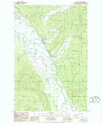
Editions of this 1986 Malone Map
2 editions found
Other maps of this area

1939 · Shelton
USGS Topo · 1:62,500

1941 · Gate
USGS Topo · 1:62,500

1941 · Ford
USGS Topo · 1:62,500

1943 · Nahwatzel Lake
USGS Topo · 1:62,500

1953 · Hoquiam
USGS Topo · 1:250,000

1953 · Rochester
USGS Topo · 1:62,500

1953 · Malone
USGS Topo · 1:62,500

1953 · Shelton
USGS Topo · 1:62,500

1953 · Elma
USGS Topo · 1:62,500

1957 · Hoquiam
USGS Topo · 1:250,000