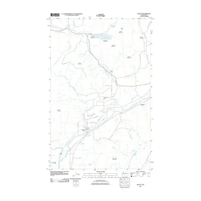
2011 Map of Malott
USGS Topo · Published 2011About this map
The Okanogan River winds through the heart of this region, shaping the local geography near the settlement of Malott. This 2011 survey highlights the intersection of water and terrain, where Tallant Creek and Loup Loup Creek drain the surrounding highlands. Significant landmarks include the Malott Post Office and the Chilliwist Cemetery, which offer valuable points of reference for those researching local family history.
Find a feature on this map
45 named features on this map. Tap any name to fly to it.
Don’t see what you’re looking for? This feature index may not catch every label — zoom into the map to look around manually.
Map Details
Editions of this 2011 Malott Map
This is the sole edition of this map. No revisions or reprints were ever made.
Other maps of this area

1905 · Okanogan
USGS Topo · 1:125,000

1954 · Okanogan
USGS Topo · 1:250,000

1956 · Loup Loup
USGS Topo · 1:62,500

1957 · Okanogan
USGS Topo · 1:62,500

1957 · Bridgeport
USGS Topo · 1:62,500

1957 · Brewster
USGS Topo · 1:62,500

1958 · Okanogan
USGS Topo · 1:250,000

1980 · Okanogan
USGS Topo · 1:24,000
1980 · Omak
USGS Topo · 1:24,000
1980 · White Lakes
USGS Topo · 1:24,000