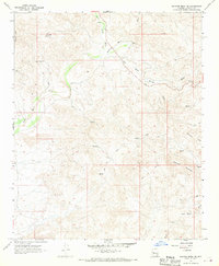
1967 Map of Malpais Mesa NE
USGS Topo · Published 1970About this map
The Santa Maria River carves a winding path through this western Arizona landscape, providing the primary hydrological artery for a network of ephemeral drainages. The terrain is marked by high points like Crosby Mtn and Grayback Mountain, which overlook a series of complex washes including Little Shipp Wash and McCloud Wash. Historically, this area was a site of extractive interest, as evidenced by the Crosby Mine and Swiss Bell Mine located in the western hills.
Find a feature on this map
17 named features on this map. Tap any name to fly to it.
Don’t see what you’re looking for? This feature index may not catch every label — zoom into the map to look around manually.
Map Details
Editions of this 1967 Malpais Mesa NE Map
2 editions found
Other maps of this area

1887 · Prescott
USGS Topo · 1:250,000

1892 · Prescott
USGS Topo · 1:250,000

1903 · Congress
USGS Topo · 1:125,000

1904 · Congress
USGS Topo · 1:125,000

1923 · Signal
USGS Topo · 1:250,000

1942 · Signal
USGS Topo · 1:250,000

1945 · Bagdad
USGS Topo · 1:62,500

1947 · Sheridan Mountain
USGS Topo · 1:62,500

1948 · Sheridan Mountain
USGS Topo · 1:63,360

1948 · Bagdad
USGS Topo · 1:62,500