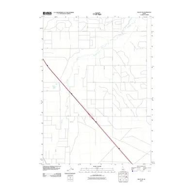
2010 Map of Malta NE
USGS Topo · Published 2010About this map
The Raft River meanders across this high desert landscape in Cassia County, providing a vital water source for the surrounding agricultural grid. Irrigation and access roads define the human footprint here, with a highly organized system of section lines and named routes like Idahome Ln and Nellies Ln. The presence of Beet Dump Rd in the north points to the region's historical and economic ties to sugar beet farming, a staple industry of the Snake River Plain vicinity. While much of the terrain is dominated by wide-open spaces, seasonal waterways such as Warm Creek intersect the farmland. The interstate corridor cuts a sharp diagonal through the southwestern portion of the quadrangle, contrasting the modern transportation network with the older rural roads like Hiria Rd that serve the local ranching and farming operations.
Find a feature on this map
12 named features on this map. Tap any name to fly to it.
Don’t see what you’re looking for? This feature index may not catch every label — zoom into the map to look around manually.
Map Details
Editions of this 2010 Malta NE Map
This is the sole edition of this map. No revisions or reprints were ever made.
Other maps of this area

1954 · Pocatello
USGS Topo · 1:250,000

1958 · Pocatello
USGS Topo · 1:250,000

1958 · Sublett
USGS Topo · 1:62,500

1959 · Lake Walcott
USGS Topo · 1:62,500

1959 · Yale
USGS Topo · 1:62,500

1968 · Malta NE
USGS Topo · 1:24,000

1968 · Malta
USGS Topo · 1:24,000

1968 · Idahome
USGS Topo · 1:24,000

1968 · Nibbs Creek
USGS Topo · 1:24,000

1984 · North Chapin Mountain
USGS Topo · 1:24,000