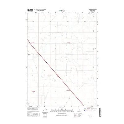
2017 Map of Malta NE
USGS Topo · Published 2017About this map
The Raft River Valley landscape in Cassia County is defined by its characteristic high-desert hydrology and the persistent grid of the Public Land Survey System. The Raft River itself winds through the western portion of this quadrangle, flanked by seasonal drainage such as Warm Creek. This 2017 survey shows how the historic agricultural and ranching corridors of the region are maintained through a structured network of section-line roads, including Idahome Rd and 800 S Rd. The spatial organization here reflects the late-century evolution of rural Idaho, where large-scale land management and irrigation needs dictate the placement of transportation routes like 1000 S and 300 Rd S across the valley floor.
Find a feature on this map
14 named features on this map. Tap any name to fly to it.
Don’t see what you’re looking for? This feature index may not catch every label — zoom into the map to look around manually.
Map Details
Editions of this 2017 Malta NE Map
This is the sole edition of this map. No revisions or reprints were ever made.
Other maps of this area

1954 · Pocatello
USGS Topo · 1:250,000

1958 · Pocatello
USGS Topo · 1:250,000

1958 · Sublett
USGS Topo · 1:62,500

1959 · Lake Walcott
USGS Topo · 1:62,500

1959 · Yale
USGS Topo · 1:62,500

1968 · Malta NE
USGS Topo · 1:24,000

1968 · Malta
USGS Topo · 1:24,000

1968 · Idahome
USGS Topo · 1:24,000

1968 · Nibbs Creek
USGS Topo · 1:24,000

1984 · North Chapin Mountain
USGS Topo · 1:24,000