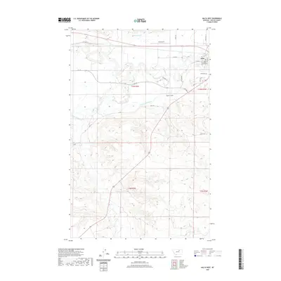
2020 Map of Malta West
USGS Topo · Published 2020About this map
The Milk River meanders through the heart of this landscape, its complex oxbows and former channels shaping the terrain west of Malta. This region is defined by its sophisticated agricultural irrigation infrastructure, anchored by the Dodson N Canal to the north and the Dodson South Canal which carves through the southern sections. The city of Malta serves as the focal point, where the Phillips County Courthouse stands near the intersection of several local thoroughfares like River Dr and S 1st St W. The survey captures the transition from the organized town grid and the Malta Airport to the expansive drainage basins of Alkali Cr and Exeter Cr. Notable local landmarks include Taylor Coulee and roads with historical resonance, such as Kid Curry Rd, reflecting the deep ranching and frontier heritage of Phillips County.
Find a feature on this map
30 named features on this map. Tap any name to fly to it.
Don’t see what you’re looking for? This feature index may not catch every label — zoom into the map to look around manually.
Map Details
Editions of this 2020 Malta West Map
This is the sole edition of this map. No revisions or reprints were ever made.
Other maps of this area

1953 · Havre
USGS Topo · 1:250,000

1954 · Glasgow
USGS Topo · 1:250,000

1957 · Glasgow
USGS Topo · 1:250,000

1957 · Havre
USGS Topo · 1:250,000

1958 · Glasgow
USGS Topo · 1:250,000

1958 · Havre
USGS Topo · 1:250,000

1964 · Dodson NE
USGS Topo · 1:24,000

1965 · Wagner
USGS Topo · 1:24,000

1965 · West Alkali Reservoir
USGS Topo · 1:24,000

1968 · Malta West
USGS Topo · 1:24,000